News

GIS: More than a Mapping Tool

By Anton Adams, Summer Intern.
GIS stands for Geographic Information System(s). It is a collection of computer tools that allows people to work with data that are linked to specific locations on Earth.
GIS is much broader and complex than a computer mapping system. It is a database, which can be used for capturing, storing, checking, and displaying data, all while having the capability to interface with map data.
What can GIS do?
GIS can be used for various applications, such as: land use planning, environmental management, and business marketing. Any project that implements spatial data will find this technology beneficial.
For example, if researchers at the Pennsylania Game Commission wanted to conduct a study of black bear habitat in the state by placing radio transmitter collars on about 1,000 bears, they could track the animals using these collars and a handheld antenna to obtain their locations. These locations could be collected, allowing researchers to study the traits of black bear habitat.
The locations could then be entered into a GIS system for record keeping and analysis. Each location could become a point with attached information, which could include the animal’s ID number and the date and time of the sighting. In addition, this method could be used to track the number of harvested bears throughout the state.
How is GIS Used at PCCD?
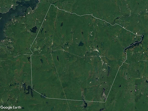
GIS is a tool used at the Pike County Conservation District for construction project site assessments, to view changes in aerial imagery over time, to conduct Pennsylvania Natural Diversity Inventory (PNDI) searches, and to map wetland types. Furthermore, when our technical staff are in the field, they can bring up a map on Google Earth to observe an area for its topography.
For example, if a person wants to build a dock on his or her property, our technical staff can use GIS to see if the dock site is a wetland or not. This information, in combination with other site factors, would help to determine whether a permit may be needed.
Ways to Learn GIS:
There are multiple ways one can learn GIS online. A quick search of the web will show a variety of courses covering topics such as: imagery, getting started with applications that utilize map data, creating mobile-friendly GeoApps, or learning how to write coding languages with various programs.
For pepole who want a more structured way of learning, an educational institute such as a college or university would be another option. These institutions can provide a precise set of classes that teach about the principles of GIS, cartography, database management, and spatial analysis. In addition, there are tutorials that can teach students from K-12 grade on how to use GIS.
GIS is a great resource for accessing maps. It’s a software that can make visualizing an area much easier.
GIS is an important tool for professionals in natural resource management, land use planning, public services, and more. It can be taught at almost any level of education.
Defintions:
GIS – geographic information system. Can be used to store and manipulate geographic data on a computer system.
Database – an organized collection of data.
PNDI – Pennsylvania National Diversity Inventory. Helps identify impacts to threatened, endangered or rare plants, animals, natural communities, and geologic features throughout Pennsylvania.
